
Property Line Survey Before Trees Are Removed Along an HOA Boundary
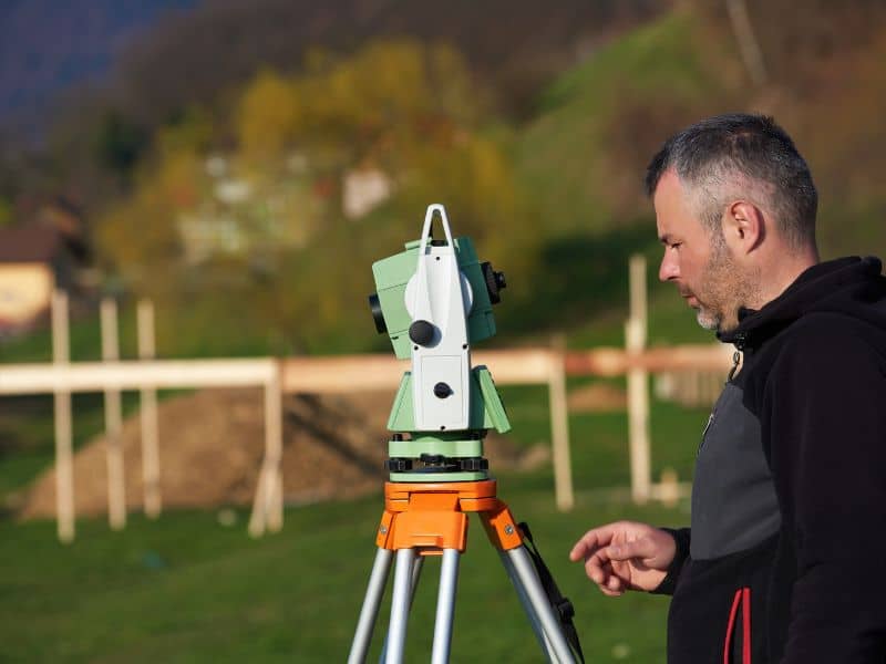
Plan tree removal near an HOA boundary with a property line survey that shows where your land ends and common areas begin.
A mature tree can take decades to grow and only an afternoon to cut down. If that tree sits on or near an HOA boundary, the wrong cut can lead to fines, replacement costs, and years of tension with the neighborhood. A property line survey done before the crew arrives shows exactly where your land ends and the HOA’s common area begins. That one step protects your budget, your schedule, and your standing with the association.
This matters most for developers, builders, and site contractors clearing land next to established neighborhoods. It also matters for owners of single lots that back up to greenbelts, drainage areas, or shared buffer strips. The takeaway is simple. Confirm the line first, mark it clearly, and only then let the saws run.
Why HOA Boundary Trees Need a Property Line Survey First
Trees along an HOA boundary are often owned by the association, not the lot owner. Many HOAs keep tree rows as screening buffers, and some plats show them inside buffer or planting easements. Removing a tree on common area land without approval can trigger fines, a demand to replace the tree, or a claim for damages. Rules and penalties vary by HOA, city, and county, so check the declaration and any local tree rules before work starts.
Fences and old tree lines make poor guides. A fence line may sit a few feet off the true property line because an earlier owner built it where it was convenient rather than where the deed indicated.
What a Boundary Survey Tells You
A licensed surveyor researches the deed, the recorded plat, and nearby surveys. They search the site for monuments, which are physical markers like iron rods or capped pins set at lot corners. Then they compare what they find to the record and show the result on a drawing you can share with the HOA and your crew.
Locating the Property Line Around Trees and Landscaping
Trees make fieldwork slower. Dense canopy can weaken GPS signals, so surveyors often switch to a total station, a tool that measures angles and distances from known points. Roots and years of leaf litter can also bury corner pins, which means some careful digging with a metal detector is normal.
Once the line is set, the surveyor can locate key trees in relation to it. Ask them to tie in any tree within a set distance of the line, such as 10 or 15 feet, and to note trunk size where it helps. Trees whose trunks straddle the line deserve extra attention. These are often treated as shared, and removing one without the other owner’s consent can cause real trouble.
Canopy and roots don’t stop at the line. A tree on HOA land may have branches over your lot and roots under your future pad. Trimming and root cutting still need care, so talk with an arborist and the HOA before cutting into roots from a common area tree.
Comparing Survey Evidence With HOA Plats and Common Areas
The recorded plat is the map that created the lots and common areas. It shows lot lines, common area tracts, easements, and often notes about buffers or tree save areas. Your surveyor compares the field evidence to this plat and to any later replats or amendments.
Good records make the comparison faster and more reliable. Pull these before fieldwork starts, or ask your surveyor to help find them. Most are recorded with the county or kept by the HOA’s management company.
- The recorded plat and any replats for the subdivision
- The HOA declaration and any tree or buffer rules
- Easements for drainage, utilities, or access that cross the tree line
- Any tree preservation plan tied to your permit
Differences come up more often than people expect. A monument may have been disturbed during an earlier buildout, or a common area may have been adjusted by a replat that few people remember. When evidence and record disagree, the surveyor weighs them using accepted boundary principles and notes the issue on the drawing.
If a real conflict shows up, pause the removal plan. Bring the survey to the HOA board and, if needed, to a real estate attorney or title company. Settling the line on paper is far cheaper than settling it after the trees are gone.
Marking Boundary Limits Before Tree Removal Crews Begin
A drawing in the office doesn’t help a crew in the field. Ask the surveyor to stake the line with lath and bright flagging, placed close enough that each stake can be seen from the next. On wooded lots, that may mean stakes every 25 to 50 feet, or closer where the line bends.
Mark the trees too. A common approach uses one paint color or ribbon for trees to remove and another for trees to protect. Walk the line with the crew lead before work starts, and make sure they know that nothing past the stakes gets touched.
Protect the marks during the job. Heavy equipment knocks stakes over, and crews sometimes move them to get room to work. If stakes go missing, call the surveyor to reset them instead of guessing. A quick restake costs far less than a tree that was cut by mistake.
Reducing Risk for Developers, Lenders, and Project Teams
For developers, a clear boundary protects the schedule. A dispute with an HOA can stop clearing, delay grading, and push back permits. Many cities also review tree removal as part of site plan approval, and a survey showing trees near the line can make that review go more smoothly.
Lenders and title companies want to know the project stays inside the property. Encroachment onto common area land can raise title questions that surface late, often near a draw or a closing. A current survey gives them a clean record to work from.
Contractors and engineers benefit as well. The survey can serve as the base for grading plans, tree save plans, and later construction staking. Survey needs vary by lender, title company, city, and project scope, so confirm what’s required early, before clearing dates are locked in.
