
ALTA Survey Details That Matter When an Office Campus Becomes Mixed Use
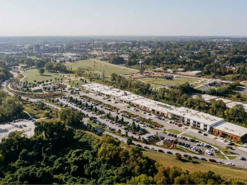
An office park built for one company looks very different once it turns into apartments, shops, and workspace mixed together. New uses share the same roads, lots, and pipes that once served a single tenant. Before that switch happens, an ALTA survey maps what’s really on the ground. It shows the roads, easements, buildings, and property lines a redevelopment team has to plan around. Guessing at those details invites expensive surprises later. The survey gives everyone the same honest starting point.
Sort Out Roads and Entrances Everyone Will Share
One company can run a campus however it likes. Split that campus into homes, stores, and offices, and suddenly a lot of people share the same drive aisles. An ALTA survey maps the internal roads, entrances, and drive lanes across the whole site. That drawing shows how each new use will reach the street and move around.
Shared roads get tricky once you mix. Shoppers, residents, and office workers all want the same lanes at different times of day. The survey lays out where those routes run, so planners can see which ones need to stay open to everyone. It also flags spots where one use might block another.
Spot Easements That Box In New Building Spots
Easements are rights that let someone use part of your land for a set purpose. A power line, a drainage path, or a shared driveway can all sit inside one. An ALTA survey shows these on the map, along with where they run. That matters because you usually can’t build on top of them.
When you plan new housing or a retail strip, those easements can shrink your options. A drainage easement crossing the middle of the site might rule out a building you wanted there. Seeing them early lets the design team place new structures where nothing gets in the way. It saves a redesign after someone finds the conflict.
Take Stock of Parking Before You Split It Up
Office campuses tend to have big parking lots built for weekday crowds. Turn part of the site into apartments and shops, and that parking has to serve new demand. An ALTA survey documents the existing lots, any parking garages, and the drive lanes that feed them. It counts and locates what’s already there.
That record matters once spaces get reassigned. Residents need reserved spots, and shops need room for customers. If planners carve up the lots without accurate data, someone ends up short. The survey gives a clear map of current parking, so the team can divide it in a way that actually works.
Find Existing Structures That Clash With the Plan
Every campus is full of things already built. Buildings, sidewalks, retaining walls, loading docks, and utility boxes all sit somewhere on the site. A survey for commercial property helps document where those features stand before redevelopment plans move forward. Lay the redevelopment plan over that survey, and conflicts jump out.
Maybe a planned road runs straight through a retaining wall. Maybe a new building lands on top of a utility structure that’s expensive to move. Catching those clashes on paper is cheap. Catching them after crews start work is not. The survey lets designers adjust before any of it becomes a real problem.
Keep One Reliable Map for Every Phase
Big conversions rarely happen all at once. Often one office building keeps running while crews rebuild another part of the campus. That kind of staged work needs a single, trusted map everyone shares. An ALTA survey gives the whole project that common base.
Each phase can point back to the same survey for lot lines, easements, and existing features. When phase two starts, the team isn’t guessing about what phase one left behind. Clear records of current conditions keep the phases lined up. They also help avoid mistakes where one stage undoes the work of another.
Frequently Asked Questions
Why is an ALTA survey useful when an office campus is converted to mixed use?
An ALTA survey maps the roads, easements, buildings, and boundaries across the whole campus. Mixed-use conversion adds new occupants who share those same features. The survey shows planners what exists before they redesign the site. That reduces the risk of costly conflicts once construction starts.
Can an ALTA survey show shared roads and access areas within a campus?
Yes, an ALTA survey documents drive aisles, internal roads, and entrances. It shows how vehicles move through the site and reach the street. This is key when homes, shops, and offices start sharing the same routes. The map helps planners keep access clear for every use.
How can existing easements affect mixed-use redevelopment plans?
Easements give others the right to use part of the property for a set purpose. You usually can’t build on top of a utility, drainage, or access easement. An ALTA survey shows where these run across the campus. Knowing that early keeps new buildings out of spots that are already spoken for.
Does an ALTA survey document parking lots and other site improvements?
Yes, the survey records parking lots, garages, drive lanes, and similar features. It locates and measures what’s already built on the site. This information matters when parking gets reassigned to new uses. Accurate data helps the team split spaces without leaving anyone short.
Should an ALTA survey be updated when redevelopment happens in multiple phases?
Updating the survey during phased work is a smart move. Each phase changes the site, so the map can drift from reality over time. A current survey keeps every stage working from accurate conditions. That consistency helps the phases fit together instead of clashing.
